Territory Planning
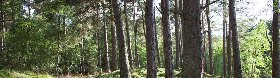
Photo credit: Christian Gonzalez
Schéma d’aménagement et de développement
The Schéma d’aménagement et de développement révisé (SADR) is an essential tool for guiding the organization and development of the territory of the MRC de Vaudreuil-Soulanges. It leads the actions of different stakeholders according to governmental guidance and expectations as well as those contained in the Montreal Metropolitan Community’s Plan métropolitaine d’aménagement et de développement.
En vertu de l’article 57 de la Loi sur l’aménagement et l’urbanisme, la MRC de Vaudreuil-Soulanges publie un résumé de son Schéma d’aménagement et de développement révisé troisième génération (SADR3), entré en vigueur le 23 janvier 2023.

Le SADR3 est le fruit de trois années de concertation régionale et reflète les aspirations du milieu entre autres en matière d’aménagement du territoire, de développement économique, de protection de l’environnement, de la mise en valeur des territoires ruraux et urbains, de la mise en valeur de nos équipements régionaux, de l’implantation de l’hôpital régional et du pôle santé et de la protection de notre patrimoine bâti et de notre patrimoine immatériel. Il harmonise la planification du territoire des municipalités faisant partie de la MRC et préconisant des actions.
Le schéma est un outil de :
- Connaissance pour les élus et les citoyens; il informe sur les enjeux particuliers et les principales caractéristiques socioéconomiques et physiques du territoire;
- Concertation entre les municipalités, la MRC, la Communauté métropolitaine de Montréal et le gouvernement afin d’avoir une vision commune et défendre des projets;
- Mise en œuvre qui recense les échéanciers, les partenaires et les diverses modalités de réalisation des projets privilégiés sur le plan régional.
Le SADR3 est structuré en trois parties :
Partie 1 : Le territoire et sa planification
- Le concept d’organisation spatiale;
- La présentation du territoire et des secteurs d’affinités.
Partie 2 : Les enjeux, les orientations et les mécanismes de mise en œuvre
- La gestion optimale du territoire et la qualité des milieux de vie;
- Le territoire et les activités agricoles;
- Le développement économique et les lieux d’emplois;
- La valorisation du territoire : le récréotourisme, la culture et le patrimoine;
- L’environnement et les milieux naturels;
- Le mont Rigaud;
- Le parc Régional du Canal de Soulanges et ses abords;
- Le transport et la mobilité durable;
- Les contraintes, la gestion des risques et les réseaux majeurs;
- Les grandes affectations.
Partie 3 : Les annexes descriptives
- Les annexes descriptives.
Révision en cours
Mise en contexte
Qu’est-ce que le schéma d’aménagement ?
Selon la Loi sur l’aménagement et l’urbanisme (LAU), le schéma d’aménagement est un document qui « planifie l’aménagement et le développement durables du territoire de la municipalité régionale de comté. Il en définit les grandes orientations et contient des objectifs, des cibles ainsi que toute autre mesure propre à assurer ou à favoriser sa mise en œuvre » (Article 5). Le schéma permet à la MRC de guider les planifications des municipalités de son territoire afin d’assurer un développement concerté et unifié, tout en répondant aux besoins d’une région dynamique et multidimensionnelle.
Le schéma d’aménagement vise à concrétiser les aspirations de son énoncé de vision stratégique, dans lequel la MRC établit ses aspirations pour le développement culturel, économique, environnemental et social de son territoire.
La LAU prévoit que les MRC révisent leurs schémas régulièrement en suivant la hiérarchie de concordance (figure ci-dessous). Le schéma de la MRC découle des visions et orientations du gouvernement, via les orientations gouvernementales en aménagement du territoire (OGATs) et de la CMM, via son Plan métropolitain d’aménagement et de développement (PMAD). À leur tour, les règlementations des municipalités doivent suivre les orientations du schéma de la MRC. Ainsi, une approche collaborative est souhaitée à la révision du schéma.

Figure – Cadre légal d’élaboration du schéma d’aménagement
Pourquoi réviser le schéma ?
- En 2024, le gouvernement du Québec a adopté de nouvelles orientations en aménagement du territoire (OGAT) auxquelles les schémas des MRC doivent se conformer. De plus, en décembre 2025, le Plan métropolitain d’aménagement et de développement révisé (PMADr) de la CMM est entré en vigueur, déclenchant du même coup le compte à rebours de 3 ans octroyé par le ministère des Affaires municipales et de l’Habitation (MAMH) pour se conformer aux nouvelles OGAT et au PMADr.;
- Pour s’assurer qu’il réponde aux besoins actuels du territoire : La dernière révision du schéma d’aménagement date de 2015, même si celui-ci est entré en vigueur en 2023. Entre-temps, le territoire de la MRC a beaucoup changé et un schéma à jour permettra d’intégrer les données les plus récentes et de produire des normes plus représentatives;
- Pour modifier sa structure : La structure actuelle du schéma d’aménagement de la MRC ne permet pas facilement à ses lecteurs (surtout les firmes privées et les municipalités) de l’utiliser comme guide de référence. Une révision de sa structure permettra à la MRC de l’adapter aux besoins des municipalités. La solution envisagée est de revenir à une structure de schéma plus standard telle qu’utilisée par la plupart des MRC;
- Une révision du schéma pourra également permettre à la MRC d’intégrer les planifications assurées par ses autres documents, tels le Plan climat, le Plan régional des milieux humides et hydriques (PRMHH), ou le nouveau Plan de développement de la zone agricole (PDZA), pour ne nommer que ceux-ci.
Une démarche collaborative
- La révision du schéma se fera de manière collaborative, en consultation avec les nombreux organismes et acteurs du territoire;
- Un comité interne, composé d’employés de la MRC dont les dossiers contribuent à la rédaction du schéma (p. ex. environnement, développement social, etc.), sera mis en place;
- Des comités externes seront également créés en fonction de différentes thématiques et seront essentiellement composés des responsables de l’urbanisme des municipalités constituantes, d’organismes partenaires et d’organismes communautaires. Les élus seront également invités à se joindre aux comités selon leurs intérêts;
- Des ateliers de travail avec les partenaires du milieu seront tenus dans le cadre de l’élaboration de l’énoncé de vision stratégique en amont de l’adoption et une consultation publique sur le projet d’énoncé se tiendra par la suite;
- Le service de l’aménagement a également l’intention de consulter la population après le premier projet de schéma d’aménagement afin d’en faciliter son appropriation en amont de l’adoption du deuxième projet et de la consultation publique obligatoire qui en découlera.
Les thématiques
La rédaction du schéma d’aménagement et les activités de consultations gravitant autour de ce grand projet aborderont les thématiques suivantes :

La ligne du temps

Politique de l’arbre et des boisés
La Politique de l’arbre et des boisés propose des axes d’interventions pour protéger et valoriser le couvert forestier visant à dynamiser les initiatives en termes de mise en valeur du patrimoine naturel. Celle-ci s’adresse aux municipalités, aux citoyens et aux agents de développement de la région. La politique a trois axes d’intervention principaux :
- Informer et sensibiliser quant aux rôles et aux fonctions des arbres et des boisés;
- Favoriser le reboisement et la protection des arbres et des boisés pour répondre à divers besoins en termes de développement durable;
- Inciter la mise en valeur des forêts et favoriser les bonnes pratiques d’aménagement forestier et de sylviculture.
Sustainable forest management involves considering the forest as an ecosystem where a variety of components interact with each other. Therefore, the forest generates and influences several resources including wood, wildlife and their habitat, water, sun, and scenery. In Montérégie, many MRCs have been adopting logging regulations since 1998. Black ice and new trends towards liquid manure spreading in agricultural environments are factors that accelerate deforestation, as demonstrated by three studies completed since 2002 that covered the Monteregian territory. These assessments also apply to the MRC de Vaudreuil-Soulanges. Furthermore, in addition to the agricultural context, the MRC is facing accelerated development of its infrastructures and urbanization. The natural environments of the eastern portion of the territory, being in a high-development zone of the Montreal region, are more subject to this type of pressure. In this context, the MRC de Vaudreuil-Soulanges is proposing measures for the protection and improvement of woodlands. The Politique de l’arbre et des boisés was written as part of this proactive step that aims to revitalize regional initiatives in terms of improving natural heritage.
Plan de développement de la zone agricole
La MRC de Vaudreuil-Soulanges est responsable de l’élaboration d’un Plan de développement de la zone agricole pour les 23 municipalités de son territoire. Cet outil de planification dresse d’abord un portrait de la situation agricole sur le territoire pour ensuite proposer des interventions concrètes contribuant au développement durable, à la pérennité et au rayonnement des activités agricoles de la MRC.
Révision en cours
Mise en contexte
Ce projet a été financé par le ministère de l’Agriculture, des Pêcheries et de l’Alimentation du Québec.
Le Plan de développement de la zone agricole de la MRC Vaudreuil-Soulanges a fêté son 10e anniversaire le 25 juin 2024. Depuis, le territoire de la MRC a connu un important développement et une forte croissance. Le bilan du PDZA de 2014 a révélé que ces changements ont eu une incidence sur le développement de la zone agricole de la MRC et qu’il est maintenant temps d’entreprendre la révision de ce document de planification afin de comprendre les nouveaux enjeux et de pouvoir saisir les opportunités qui se présentent aujourd’hui à un territoire dont la réalité ne correspond plus à celle d’il y a 10 ans.
En plus de s’inscrire dans un contexte où les acteurs concernés démontrent une volonté claire de donner un nouvel élan au développement de la zone agricole de notre territoire, la révision du PDZA représente une opportunité de :
- corriger certaines lacunes relevées dans le premier PDZA;
- planifier le développement du territoire agricole en s’appuyant sur un portrait actualisé qui témoigne de l’évolution de la MRC de Vaudreuil-Soulanges, tout en tenant compte des nouvelles orientations gouvernementales en aménagement du territoire (OGAT), du futur plan métropolitain d’aménagement et de développement (PMAD) et de la nécessité de s’adapter aux changements climatiques;
- mobiliser de nouveaux acteurs (dont certains à l’origine de projets structurants pour la région) et améliorer les processus de consultation et de concertation.
Rappel des objectifs
La réalisation, en concertation avec les parties prenantes, du Plan de développement de la zone agricole révisé de la MRC de Vaudreuil-Soulanges a pour objectif de :
- Documenter l’évolution de la zone agricole dans les 10 dernières années;
- Présenter un nouveau diagnostic à l’image du secteur agricole de Vaudreuil-Soulanges;
- Mettre de l’avant la nouvelle vision concertée du développement de la zone agricole;
- Donner un nouvel élan au développement agricole avec une nouvelle planification stratégique adapté à la réalité du territoire.
Démarche de révision du PDZA
Afin de compléter la démarche de révision de son PDZA, la MRC a choisi de confier le mandat à une ressource externe par le biais d’un appel d’offre sur invitation. Les services de Groupe PleineTerre ont été retenu pour le projet en raison de leur approche innovante permettant d’allier aux dispositifs classiques de réalisation d’un PDZA (portrait, forum, diagnostic, plan d’action, PDZA), un dispositif issu des approches collaboratives.
La démarche alternera donc entre :
- Rencontres du comité technique : des séances de travail de type atelier de codesign
- Recherche et analyse : la recherche et l’analyse de données en soutien au travail du comité technique.
- Ancrage dans la communauté : l’organisation de forums dans le but d’ouvrir un ensemble de possibilités, de mobiliser un maximum de parties prenantes et d’alimenter le processus de co-construction du PDZA.
L’ensemble permettra aux parties prenantes de s’approprier et de participer activement à la cocréation du PDZA dans une dynamique engageante.
Comité technique
Le comité technique est formé d’une vingtaine de membres au profil diversifié (élus, producteurs agricoles, représentants de l’environnement et du développement social, économique et touristique, aménagistes et autres professionnels de la MRC), de manière à stimuler l’innovation et à s’assurer que les travaux reflètent les multiples réalités du territoire agricole de Vaudreuil-Soulanges et de ceux qui l’occupent.
Rôle des membres du comité technique :
- alimenter l’équipe de PleineTerre en partageant leurs avis, leurs connaissances et les sources d’informations dont ils disposent et qui seraient susceptibles d’aider à l’avancement des travaux;
- commenter les analyses issues des travaux de recherche et de concertation;
- se prononcer sur le contenu et les livrables du PDZA;
- recommander l’adoption du PDZA au conseil de la MRC.
Échéancier
| Date | Étapes de réalisation | |
| Printemps 2025 | 1.Démarrage Rencontre de démarrage avec le comité technique |
 |
| Été-automne 2025 | 2. Portrait Élaboration d’un portrait détaillé du territoire et des activités agricoles validé par le comité technique |
|
| Hiver 2025-2026 | 3.Diagnostic Organisation du Forum 1 (vision, éléments de valeur et enjeux stratégiques) et d’ateliers thématiques (enjeux spécifiques) pour élaborer le diagnostic validé par le comité technique |
|
| Hiver 2025-2026 | 4. Plan d’action Organisation du Forum 2 (coconstruire les projets porteurs) et élaboration du plan d’action en collaboration avec le comité |
|
| Printemps 2026 | 5. Validation du PDZA Organisation du Forum 3 (validation du PDZA, dégustation de produits du terroir et réseautage), finalisation et approbation du plan de développement par le comité technique |
 |
| Printemps 2026 | 6. Adoption du PDZA Présentation de la nouvelle mouture du PDZA aux élu.e.s pour adoption. |
 |
Légende : Rencontres du comité technique (pour les membres du comité)Forums (pour tous : milieu agricole, municipal et communautaire)Ateliers et présentations (pour une public spécifique : élu.e.s, intervenant.e.s du milieu agricole)
Version 2014 en vigueur
L’élaboration du Plan de développement de la zone agricole en vigueur a permis d’acquérir une connaissance plus fine du territoire et de ses activités agricoles en plus de créer une nouvelle dynamique de concertation entre les acteurs du milieu, d’établir un lieu d’échanges propice à la définition d’une vision concertée du développement de l’agriculture et de déterminer les meilleurs moyens d’exploiter pleinement le potentiel agricole et d’entreprendre des actions concrètes.
Le Plan de développement de la zone agricole en vigueur a pour objectif de :
- Mettre en valeur les entreprises agricoles et leurs produits;
- Viser l’accroissement ou la diversification des productions, des produits, des modèles d’entreprise ou des modes de mise en marché;
- Favoriser la reconnaissance de la multifonctionnalité de l’agriculture;
- Encourager le développement d’activités complémentaires telles que l’agrotourisme ou la transformation à la ferme.